-> Object Detection and Recognition:

At Locdus, we leverage cutting-edge artificial intelligence technologies to provide powerful solutions across both image and text-based applications. Our expertise in AI empowers businesses to unlock new opportunities by harnessing data in innovative ways.
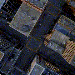
Our image processing solutions use state-of-the-art deep learning techniques to analyze, classify, and interpret visual data. Whether it's satellite imagery, remote sensing data, or any form of digital images, we offer the following services and more:
-> Object Detection and Recognition:
-> Image Segmentation and Classification:

-> Instance Segmentation
-> Image Enhancement and Super-Resolution:

-> Point Cloud AI:
-> 3D Object Reconstruction:
In the realm of text data, we apply advanced natural language processing (NLP) techniques to enable smart interpretation and analysis of large volumes of unstructured information. Our services include:
-> Text Classification: Categorizing documents, emails, or social media content based on topics, sentiments, or custom criteria.
-> Sentiment Analysis: Understanding the emotional tone behind customer reviews, feedback, or other textual content to provide valuable business insights.
-> Named Entity Recognition (NER): Identifying and classifying entities like names, dates, and locations from unstructured text, ideal for data extraction and trend analysis.
-> Document Summarization: Condensing large documents into concise summaries without losing key information, enhancing decision-making processes.
At Locdus, we provide a wide range of Geographic Information Systems (GIS) solutions designed to empower businesses, governments, and organizations with spatial data insights and advanced geospatial analytics. Our GIS expertise helps unlock the potential of location-based data to enhance decision-making, operational efficiency, and strategic planning.
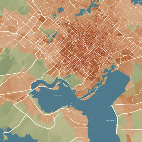
In the realm of geospatial data, we apply advanced Geographic Information Systems (GIS) techniques to enable smart visualization, analysis, and management of spatial information, empowering organizations to make data-driven decisions. Our services include:
-> Custom GIS Mapping: Developing tailored, interactive maps for urban planning, environmental monitoring, transportation, and logistics.
-> Geospatial Analytics: Providing spatial analysis for detecting patterns, trends, and anomalies in various industries like real estate, retail, and public policy.
-> Route Optimization: Solutions for optimizing transportation routes, reducing delivery times, and improving supply chain efficiency.
-> Infrastructure and Asset Management: GIS-based tracking and analysis of infrastructure such as utilities, roads, and public assets.
-> Land Use and Zoning Analysis: Using GIS to assess land suitability for agricultural, urban, or industrial development.
-> Geospatial Business Intelligence: Enabling businesses to leverage location data for market analysis, customer insights, and strategic planning.
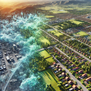
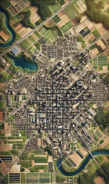
At Locdus, we offer advanced Remote Sensing solutions that provide critical insights through the analysis of satellite and aerial imagery. Remote Sensing enables organizations to monitor, assess, and manage environmental changes, urban development, and natural resources in real-time. By utilizing cutting-edge technology, we deliver accurate data and detailed analyses that support decision-making across various industries.
Our Remote Sensing services include:
-> Environmental Monitoring: With our remote sensing capabilities, we can monitor key environmental parameters such as deforestation, desertification, and biodiversity changes. Our services help track the impact of human activities and climate change, providing essential information for sustainability efforts.
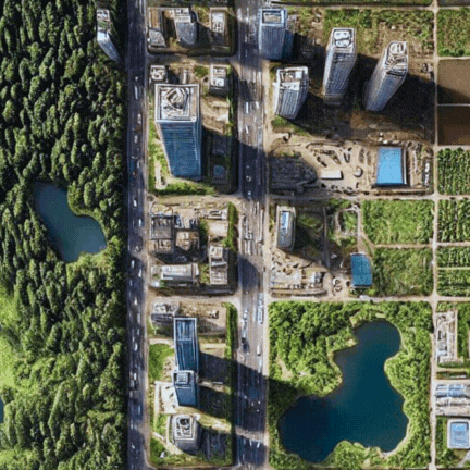
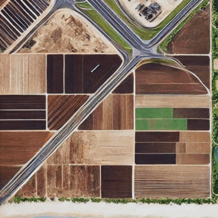
-> Land Use and Land Cover Analysis: We offer detailed land use and cover maps, enabling the monitoring of urban expansion, agricultural activities, deforestation, and natural resource management. These insights are vital for urban planning, environmental protection, and resource management.
-> Disaster Management and Risk Assessment: Our remote sensing solutions play a crucial role in disaster preparedness and response. We provide real-time monitoring and post-event analysis for natural disasters like floods, wildfires, earthquakes, and hurricanes, helping organizations mitigate risks and assess damage.
-> Precision Agriculture: We help optimize agricultural operations by providing detailed insights into crop health, soil conditions, and water usage. Our remote sensing solutions enable farmers to make informed decisions regarding irrigation, fertilization, and pest management, ultimately increasing yield and resource efficiency.
-> Urban Planning and Infrastructure Development: Remote sensing data is invaluable for urban planning, providing detailed information on land use, transportation networks, and infrastructure development. We help cities grow smarter by offering geospatial insights that support efficient infrastructure planning and sustainable urban development.
-> Coastal and Marine Monitoring: Our services extend to monitoring coastal ecosystems and marine environments. We analyze coastal erosion, sediment transport, water quality, and the impact of human activities on marine ecosystems to support sustainable development and conservation efforts.
-> Hydrology and Water Resource Management: Our remote sensing services are ideal for tracking water bodies, watershed dynamics, and hydrological changes. We provide crucial data for flood management, water resource allocation, and drought monitoring, ensuring better resource management and risk mitigation.
At Locdus, we specialize in providing comprehensive Geospatial Data solutions that enable businesses and organizations to harness the power of location-based information. Our expertise in geospatial data production, processing, and analysis allows us to deliver precise, high-quality datasets that support decision-making, planning, and operations across multiple industries. By utilizing advanced technologies, we ensure that our clients have access to accurate and up-to-date geospatial information.
Our Geospatial Data services include:
-> High-Resolution Digital Elevation Models (DEMs):We generate detailed elevation models that provide accurate topographic data for applications such as urban planning, infrastructure development, flood risk analysis, and environmental monitoring. These models are crucial for understanding terrain features and assessing land use suitability.
-> 3D Mapping and Visualization: Our geospatial solutions include the creation of 3D maps and models that offer a realistic view of landscapes, buildings, and infrastructure. These visualizations are essential for industries such as real estate, urban planning, and environmental conservation, allowing stakeholders to explore complex geographies with ease.
-> Georeferencing and Geocoding: We transform various types of data, such as satellite images, aerial photos, and ground data, into geographic coordinates. This process ensures that all datasets are accurately aligned and can be visualized and analyzed in a GIS platform. Georeferencing is essential for integrating multiple sources of spatial data.
-> Geospatial Data Integration: We combine geospatial data from diverse sources, including satellite imagery, GPS data, and other spatial datasets, into unified, actionable formats. This integration enables comprehensive analysis and insight generation for industries like agriculture, forestry, transportation, and urban development.
-> Custom Data Collection: Locdus offers tailored data collection services using the latest geospatial technologies such as drones, GPS, and mobile GIS. We collect high-precision spatial data that meets the specific needs of your project, whether it's for infrastructure monitoring, environmental studies, or asset management.
-> Geospatial Data Analytics: Our geospatial data analytics services allow businesses to uncover patterns, trends, and relationships within spatial data. We offer custom analytics solutions that support decision-making in industries such as logistics, retail, public safety, and environmental conservation.
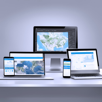
At Locdus, we offer customized software development solutions tailored to meet the unique needs of businesses and organizations in various industries. Our expertise in software engineering, combined with our knowledge of AI, GIS, and geospatial data, allows us to deliver innovative and high-performance software applications that solve real-world challenges.
Our Remote Sensing services include:
-> Web and Mobile Mapping Applications: Locdus creates web-based and mobile applications that provide real-time access to geospatial data, maps, and analytics. These applications are designed to be user-friendly, responsive, and customizable, enabling businesses to manage their spatial data from anywhere.
-> AI-Powered Applications: We develop AI-driven software applications that leverage machine learning, computer vision, and natural language processing (NLP) to automate tasks, enhance decision-making, and improve operational efficiency. Our AI software solutions are ideal for industries such as healthcare, security, logistics, and agriculture.
-> Custom Analytics Platforms: We build powerful analytics platforms that integrate geospatial data, AI models, and real-time monitoring tools. Our custom solutions enable organizations to track key performance indicators (KPIs), visualize trends, and make data-driven decisions, whether in agriculture, infrastructure management, or disaster response.
-> Enterprise Software Solutions: We develop large-scale, enterprise-level software tailored to the specific needs of industries such as logistics, finance, and government. Our enterprise solutions focus on scalability, security, and seamless integration with existing systems.
-> Automation and Workflow Optimization: We provide software solutions that automate repetitive tasks and optimize workflows, allowing businesses to increase productivity and reduce operational costs. Our automation tools streamline processes in data management, customer service, and business operations.
-> GIS Software Development: We design and develop custom Geographic Information Systems (GIS) platforms that enable businesses to visualize, analyze, and manage spatial data. Our GIS software solutions support industries such as urban planning, transportation, agriculture, and environmental monitoring, providing interactive maps, data analytics, and geospatial insights.
-> Remote Sensing Applications: Our remote sensing software solutions allow organizations to process and analyze satellite and aerial imagery with ease. Whether you need to monitor environmental changes, track land use, or assess natural resources, our applications provide the tools to turn raw data into actionable insights.